OKANOGAN HIGHLANDSFIREWATCH
· 1m ago
Back to Live Map
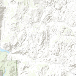
Prescribed BurnACTIVEInc# 1102· okanogan Co.
HI RX - CAMELBACK
Northeast Washington (Colville) · 2mo ago
Acres
497
Fuels
—
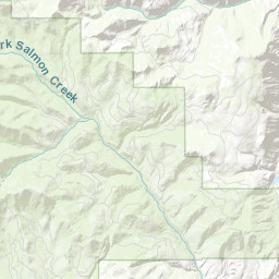
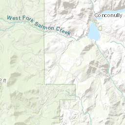
Location
OKANOGAN COUNTY - MINERAL HILL, T35 R24 S4/5
Reported
Apr 1, 2026, 09:21
Leaflet Tiles © Esri
Operational Status
ContainedPending
ControlledPending
OutPending
Incident Commander
YOUNG, STEVE
Coordinates
48.56396°, -119.84196°
Nearest Wildfire Cameras
View All →Conconully Heights
WA DNR / Pano · 4.3 mi
48.561, -119.748
Omak Mountain
WA DNR / Pano · 18.4 mi
48.435, -119.491
Twisp River
WA DNR / Pano · 19.5 mi
48.350, -120.118
Loomis Mountain
WA DNR / Pano · 19.7 mi
48.782, -119.565
Click to open in WA DNR Wildfire Watch viewer (external).
Dispatch Comment
4/29: COMPLETED BROADCAST BURN OF 140 ACRES
Field Updates · Operations Log
0 entries
No field updates yet. Be the first to post one.